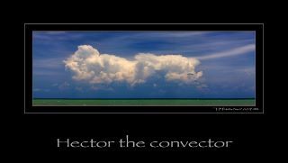
A cloud named Hector the Convector!

We have featured the art of nature many times here on the AnArt4Life blog. I think you’d agree that the colour, patterns and beauty of Mother Nature are unmatched by any other artist, regardless of whether that is in plants, flowers, birds, animals, geographic features or the sun and stars.
We’ve also looked at another aspect of Mother Nature in the past – the beauty in the formation of clouds (click here.) Today we are going to look at one phenomenum in particular, known as Hector the Convector.
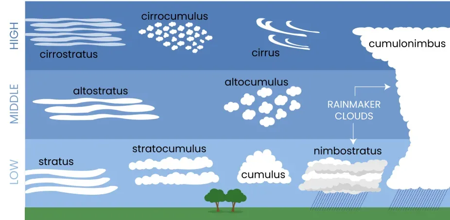
But first, a little bit of background about clouds. Did you know that there are 10 basic types of clouds? These are grouped based on their general shape and height in the sky:
• Low-level clouds (cumulus, stratus, stratocumulus) that lie below 6,500 feet (1,981 m)
• Middle clouds (altocumulus, nimbostratus, altostratus) that form between 6,500 and 20,000 feet (1981–6,096 m)
• High-level clouds (cirrus, cirrocumulus, cirrostratus) that form above 20,000 feet (6,096 m)
• Cumulonimbus, which tower across the low, middle, and upper atmosphere. 1
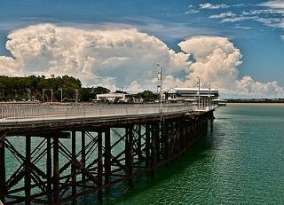
Of all the cloud formations, it is Cumulonimbus that are the thunderstorm clouds, usually heralding that severe weather is on the way. They are the only cloud type that can produce hail, thunder and lightning and possibly even tornadoes. Whilst they can create devastating damage, they are also spectacular to look at, as seen in the following short time lapse video:
They seem to boil and roll, don’t they!
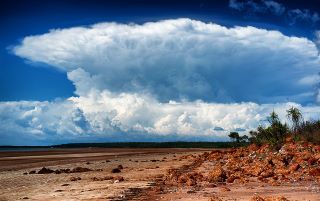
Whilst it is generally only large, one-off weather systems such as cyclones that are given names, there are some exceptions to this. One of these is a regularly occurring thunderstorm in the north of Australia named Hector, also known as "Hector the Convector." 2
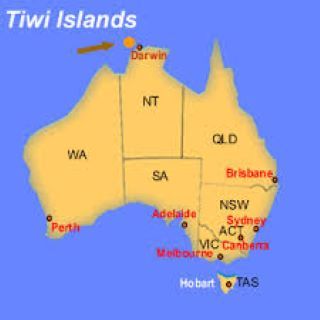
Hector is a cumulonimbus thundercloud cluster that forms at around 3pm nearly every afternoon on the Tiwi Islands, about 100kms north of Darwin in the Northern Territory of Australia, between September and March each year.
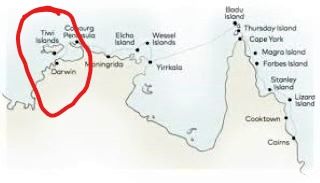
Hector's consistency is due to the several factors. The topography on the two main Tiwi Islands – Bathurst Island and Melville Island – plays a significant role. As these moisture laden sea breezes converge, they are forced upwards, through the atmosphere, where they cool and condense, forming clouds. This convection can be so vigorous that clouds reach up to 20km above sea level, making it visible from Darwin. 2
Iconic landscape photographer Tony Middleton has also captured Hector. You can read his blog about it here.
We have also looked at artist’s fascination with painting clouds like Hector. By all reports they can be difficult to get right! You might like to revisit some of these posts to see how some contemporary artists have tackled the subject. For example,
• John Pickup in oils here,
• Kevin Hill here,
• Richard McKinley in pastels here,
• Aaron Campbell using digital art here,
• and lastly, a tutorial from our Editor in Chief, Anne Newman, here.
Footnotes
- With thanks to thoughtco.com (Tiffany Means)
- With permission, weatherzone.com.au